We had twice previously made plans to pay a visit to Lesotho, the small land locked mountain kingdom embedded in South-Africa. Both attempts had been cancelled due to harsh weather. But this time, the forecast looked excellent! Our trip started off with a week-end in Ponta de Ouro south in Mozambique together with MH3, the Maputo Hash House Harriers – our drinking club with that slight running problem. Sunday the 13th of April we left Ponta do Ouro and headed towards Sani Pass, one of the few possible entries into the mountain Kingdom of Lesotho .

Handwoven wallcarpet from Lesotho, located in the dining room of Sani Pass Lodge
The mountain Kingdom of Lesotho…. Sounds pretty exotic – eh? And a little Donald Duck’ish!
The main road to South-Africa is not easy to find. This picture actually tells a lot about driving in Mozambique!
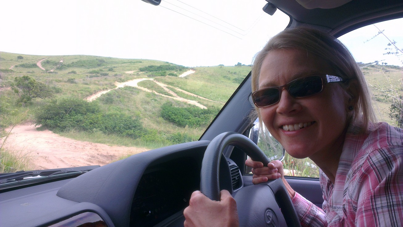
From Ponta do Ouro it is not very far to the South African border… but to find the right track can be quite a challenge! And ‘track’ is really the right expression, because the ‘road’ splits in different paths every here and there, and each of these paths run into deep sand and dense bush. Not easy to find the right one, but you will eventually reach the border and once the border is crossed, it’s all much easier. The road then switches from sandy to tarmac, and in RSA it has even got separate lanes! A highway took us to Durban within a couple of hours. From Durban, the climb towards the city of Pietermaritzburg and the mountains started. Within another couple of hours, and after a few iterations on the only CD (Johnny Cash – Hold the Line!) we’d remembered to bring in the car, we approached the town of Underberg. We’d already been in contact with the Sani Valley Lodge, but as time passed by and there was still quite a distance left and the map indicated poor road standard, we sent them a message telling we would probably not make it, and that we would look for other accommodation. Because you don’t drive in the dark in Africa if you don’t have to! And you don’t start climbing the Sani Pass if you’re totally on your own! However, the map turned out to be wrong! The road conditions showed out better than anticipated, and we realized we would make it to Sani Valley Lodge. Not in the daylight, but hopefully not in the dark night. We did however not manage to establish a new connection with the lodge, telling that we still would try to make it. An hour after darkness, we turned off the main road end entered the gate to the Lodge. After some back-and-forth discussion with the guard (appreciating his unwillingness to let unannounced guests in!!) trying to explain our situation and late arrival, we were let in and were warmly welcomed by the lodge manager, Gareth, who was quite surprised to see us! Although dinner time was long gone and his staff had returned to their houses he prepared us a nice basket of food stuff, lit the fire in our house and showed great hospitality! Thanks, great gesture!
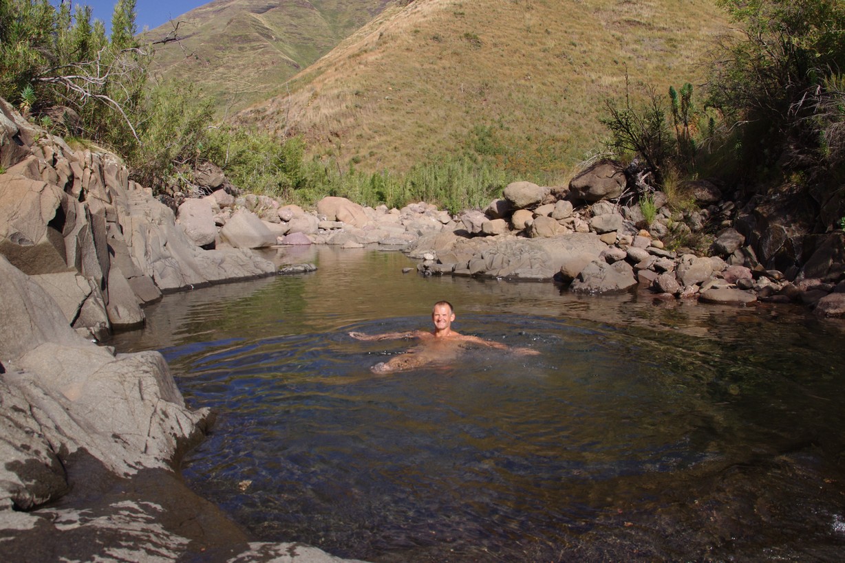
Sani Valley Lodge is beautifully located at the entry to the Sani Pass, approximately 1600 meters above sea level.

Morning has Broken, @ Sani Valley Lodge
The air so fresh, the scenery so beautiful, and with a cosy atmosphere. You can choose whether to be self-catered or to have your breakfast and dinner at the restaurant “Club House”. The lodge offers game drives and walks, and there are a few hills to climb if you want. We climbed the “Beacon Hill” just behind the lodge, and we were rewarded with a stunning view, a flock of baboons, zebras and antelopes of different kinds. The lake, the rim of which the lodge is located, provides good possibilities for trout fishing. And if the wall pictures aren’t lying; large fish can be your reward! Two nice days were spent in this beautiful place before we headed on towards our target: Sani Pass, the entrance to the kingdom of Lesotho!
Just as we were on to the road again, we passed two backpackers who were struggling with huge backpacks hiking up the first little climb… and after a micro discussion inside the car, we reversed and asked if they wanted a lift. Our new Hong-Kong chinese friends absolutely wanted a ride. I tell you : If nobody had had compassion with them, they’d probably still have been walking up that hill…

Welcome to Sani Pass Lodge!
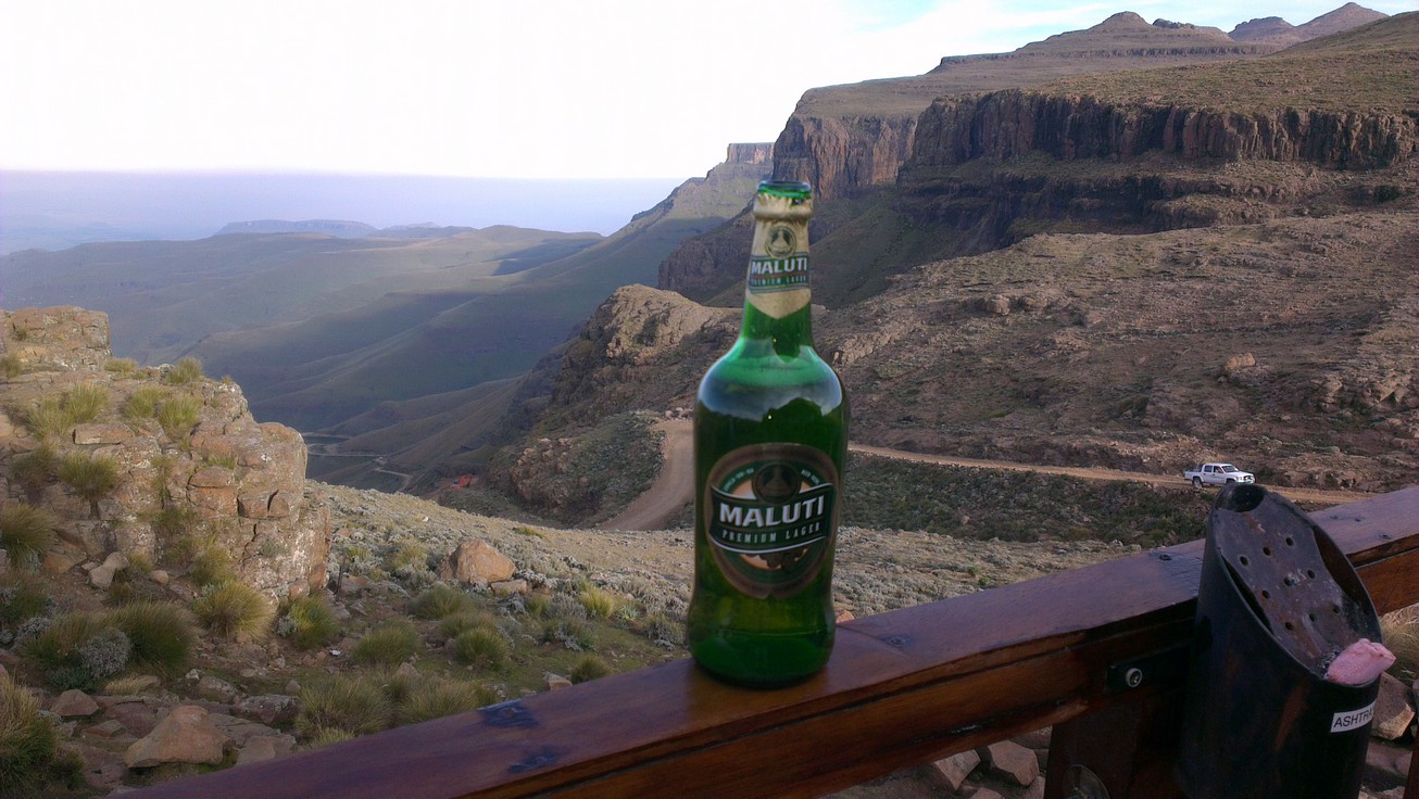
Maluti – local beer. Magnificent view of Sani Pass.
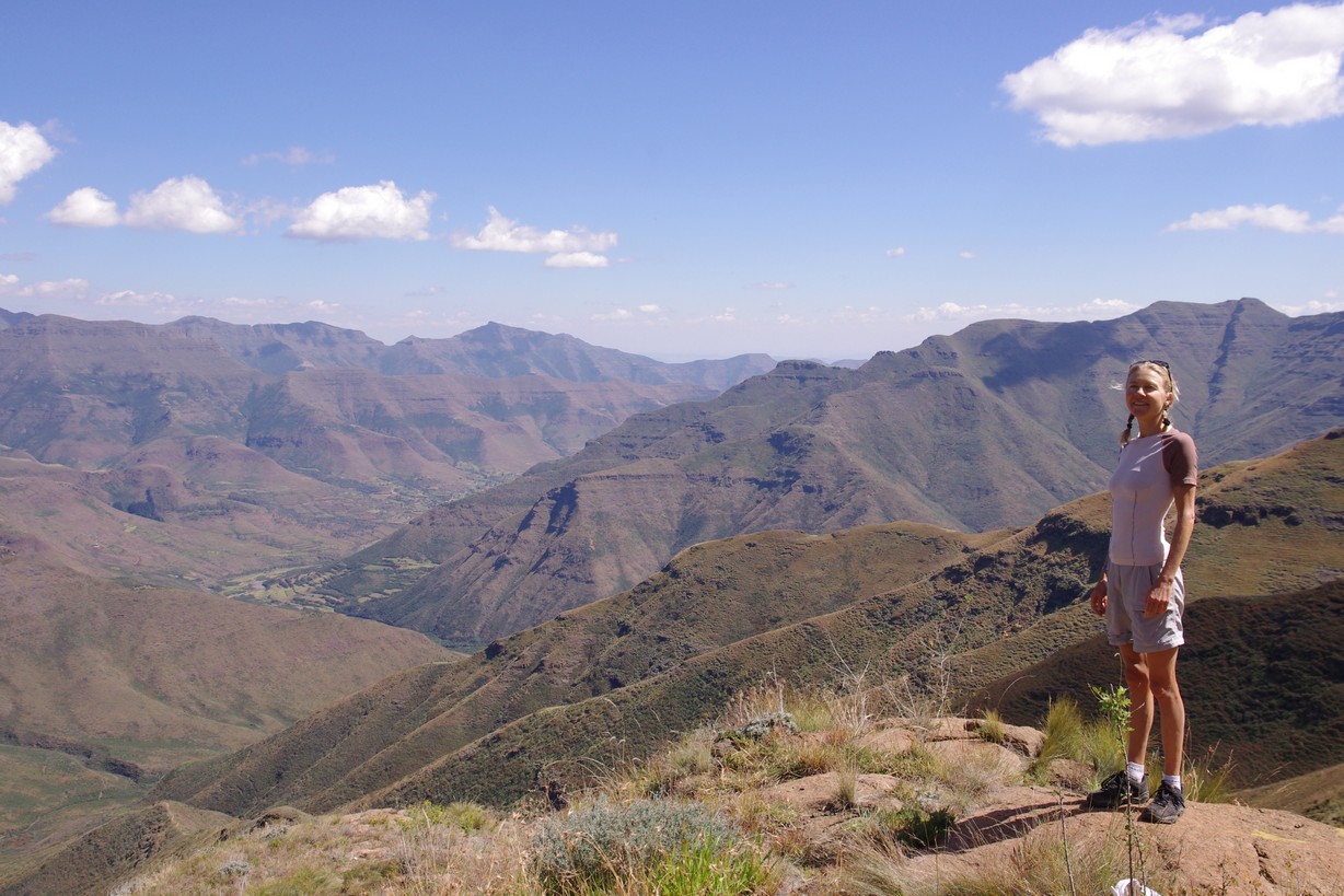
Driving up the Sani Pass is a fascinating journey. It is a coarse gravelled road; you are not allowed to go there unless you drive a 4×4, and even then it can be tough. The climb starts at about 1500 m. a.s.l. as you pass the South African border post. Then you continue the coarse gravelled road in “no-mans land”, which through a number of turns takes you up another 1300 m in about 10 km, some places as steep as a downhill ski course! The lack of oxygen in the air deteriorates the power of your car, and even our Prado was really struggling the last part, even on the lowest gear. Anyway, we made it to the top where we entered the Lesotho border post, and were awarded the most magnificent view – and “The Highest Pub in Africa” waiting for us with the local beer: Maluti!

Conquering

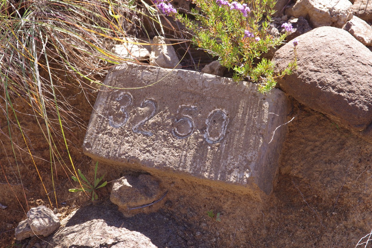
The reward at 3251 m.
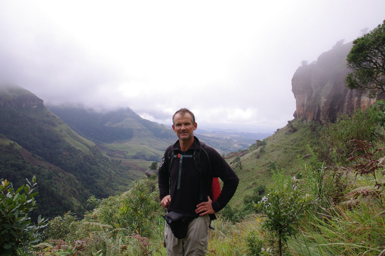
The Lesotho border actually follows the rim of the plateau at approximately 3000 m. a.s.l., and the surrounding mountains rise to the altitude of 3300 – 3400 m. One of our goals for the stay at Sani Pass was to climb some of them, among other the highest in Lesotho and actually the highest peak in Africa South of Kilimanjaro, the Thabana Ntlenyana, 3482 m. a.s.l. To do so, we started off with soma acclimatization, conquering what we believed was the highest peak in South Africa, Hodgsons Peak, only a 2 hr walk from the lodge. Unfortunately, we had not done our homework properly: Neither was the peak in South Africa (border marked by white-painted rocks), nor did we climb the highest of the Hodgsons peaks…the southern peak appears to reach 6 meter higher. Well, we climbed as we had planned to, it was the planning that was wrong! Anyway, altitude 3251 m.a.s.l. did not cause us any trouble.
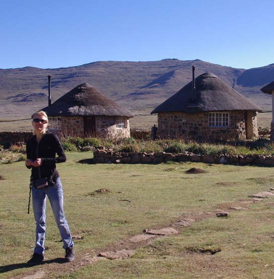
Sani Pass Lodge: Traditional Lesotho huts
Back at the lodge there were some Maluti and dinner waiting for us, before we head first dived into bed in our traditional circumpherential Lesotho hut with brown coal burning in the stove!
The climate and temperature at Sani Pass the beginning of April was quite good for mountaineering: Dry air, chilly sub-zero mornings, with temperatures rising to +20 during the day. Absolutely no wind (!) and no rain. Could it be better?
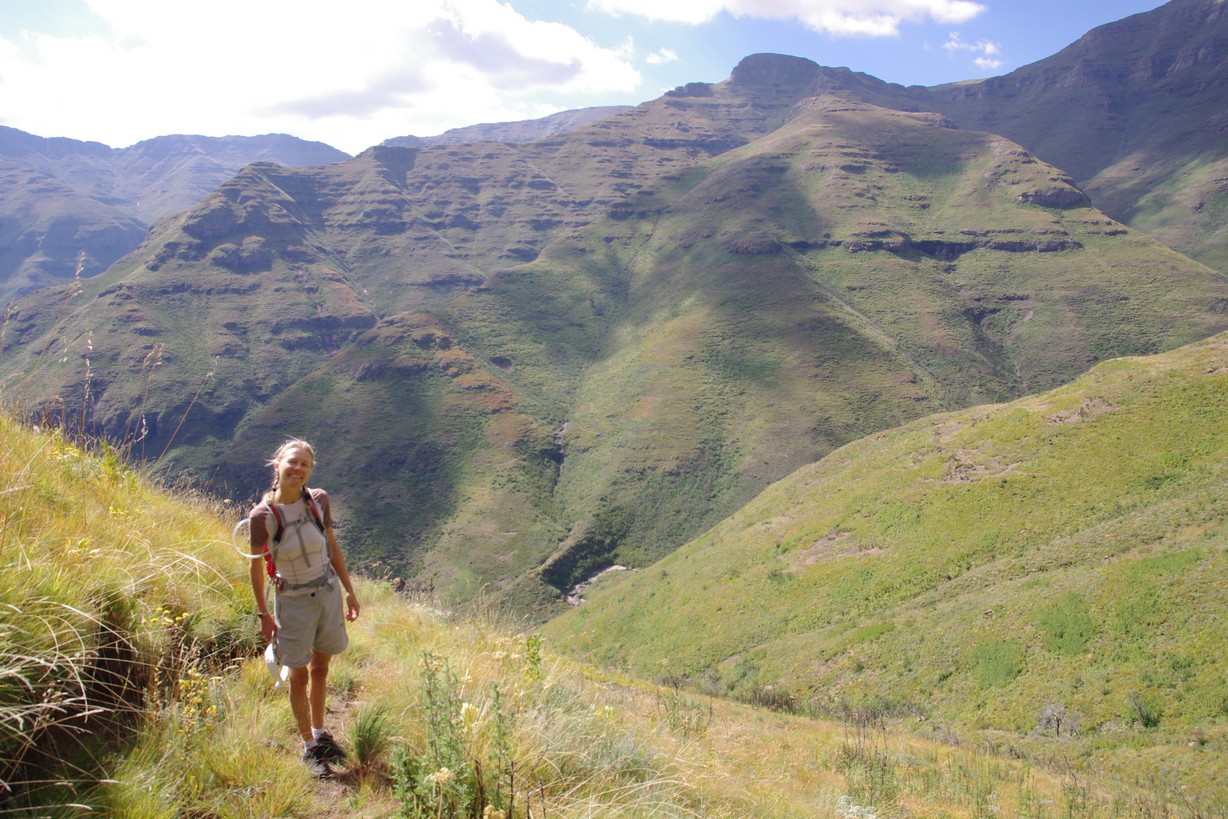
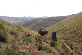
The following day we got up early and started our hike for Thabana Ntlenyana. From what we had read, this was a full day hike of 22 km, of which 90% would take place above 3000 m. altitude It turned out to be a LONG walk more than a mountain climb! At the end of the day, the walk measured 31 km long on the GPS, with a total ascent of 1000 m. Having spent the last 6 months no higher than 100 m. altitude, 8 hours of walking in lack of oxygen devastates your body! The walk took us by several traditional settlements of small huts built in stone and with the shepherds and their herds of livestock, mainly sheep and cows, in the fields and mountains. A lifestyle so far from our daily life that you feel guilty taking pictures!

3482 m

View of “half of” Lesotho!

Shepherd stone huts
Our journey continued. The next destination was the Tsehlanyane National Park. According to Lonely Planet “much underrated”, so we wanted to give it a try. Getting there from Sani Pass was a looong drive, although in actual distance not really far! Up- and down, up- and down. 2000 m. – 3300 m pass – 2000m – 3300 m pass, over- and over again! But mainly on pretty good roads. There are huge construction works related to water supplies and development of hydro power stations ongoing in Lesotho right now, in a joint cooperation with South-Africa who depends on the water supplies end electricity from Lesotho. Huge dams and tunnel works require good roads, and the infrastructure is really benefiting from this. The topology of Lesotho is indisputable, so the valleys, mountains and passes determine the road path; hence up-down, over and over again!

Afri-Ski
On our way getting there, we passed the only (?) ski resort in southern Africa, Afri-Ski, located at altitude 2500 – 3300 m. It looked interesting to us (though it was the wrong season). But demanding? Probably not much if you’re an experienced skier – like Mozwegians :-D. But probably challenging enough for most southern Africans!
Anyway, we reached the Tsehlanyane National Park after a beautiful drive. In the national park there are various options for luxury accommodation. We however chose to stay for next to nothing at the park entrance in one of the old condominiums left from the tunnel works for the Katze Dam as part of the Lesotho Highlands Water Project. Can’t say it was very pretty, so we decided to call it “Barentsburg stylish“, but we were happy! We weren’t there to sit down indoor playing cards anyway, and it was kind of clean and the beds were ok. We planned for dinner at the Maliba Lodge, a luxury lodge a bit higher up the road (2 km). After some research, we found maps of the hiking trails, and for the next day we planned a 13 km hike in a trail named “the Circular”. Maliba Lodge offered us a nice dinner before we went back to “Barentsburg” to sleep.
The following day we headed off by foot, with several water bottles, warm clothes and food in our backpacks to do “the Circular”.
Path markers
Mountains!
The trail was excellent, enjoyable and with good markings. We went “anti-clockwise”, and only one place were we a bit uncertain of finding the right way. We climbed like 900 meters to the top. The trail started on
what had likely been part of a construction road for the dam project, but from this construction road we branched off onto an ancient transport route used by the shepherds and locals for horseback transports of food and supply.

Approaching the saddle point
The Lesotho mountains – doing “The Circular”

The waterfalls
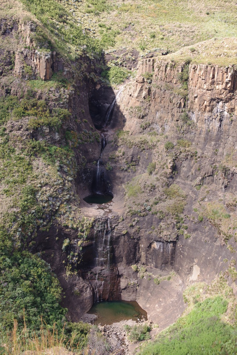
The waterfalls!
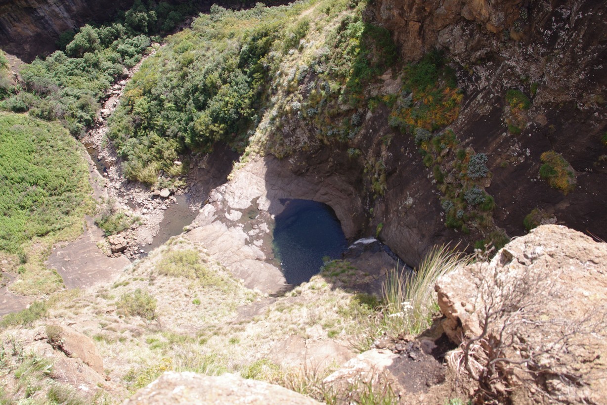
200 meters down to the pool!
A quite fascinating trail. And well marked with distance markers. At the highest point of the trail, a saddle point at 2800 m, there was a marvelous view. Going down from the saddle towards west, we reached a beautiful 3-stage waterfall. Stunning! We took a closer look by walking on to the small hillock on top of it, and it was breathtaking – steep and scary!

A swim in the natural pool
Sooo nice!

Vegetation

Nice walk – good memories
Back on the trail the vegetation got more dense, with higher grass, bamboo and fruitful trees. 3 km from the Maliba Lodge, we passed some beautiful pots in a side river in which we had a nice refreshing dip in the crystal clear water.
(In the middle of all this, Mari had a pretty stressful day. After a month or two with job-hunting, all of a sudden three offers came in, all on the same day. Which happened to be this day deep in the wilderness of Lesotho. And with one day to make up her mind. But after some hours of pondering the right decision was made!!)
From Tsclanyane our journey continued direction our next goal, Semonkong village, where we were going pony-trekking for a few days. We had to pass through Maseru, the capital of Lesotho. Maseru is actually in the low-lands of the country, and there is a beautiful vegetation of trees and flowers. “Low-lands”, though, is relatively speaking: The lowest point of Lesotho is more than 1400 m.a.s.l, and it has been told that Lesotho is actually, by average, one of the “highest” lying country in the world.
From Maseru to Semonkong is about 130 km or 3 hr drive on mainly tare roads which are currently undergoing a huge upgrade. To get there you go over the Thaba Putsoa range which has peaks of more than 3000 m high.
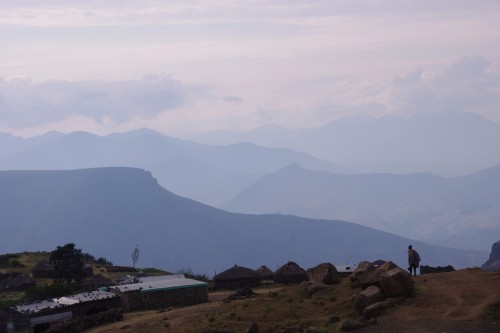
Semonkong village is situated at altitude 2200 m. On entering the village, there were not many signs pointing to our lodge, Semonkong Lodge. And when you ask people, you’re never quite sure they have understood your question, or whether they are pointing you in the right direction. But in the end, Semonkong is not a very big place, so we found our way. Close by the river, in a nice little canyon. One of the main roads passing straight through the lodge area. That doesn’t mean a lot of cars and car exhaust, but rather many horses with shepherds on their backs! Our room was very cosy, and well prepared. The lodge also has a very nice restaurant in which they served really good food, giving preference to breakfast as well as dinner. Having said that, we didn’t really discover any other options! In preparation for our overnight pony trek, we visited the local supermarket – of course run by a chinese, so opening hours was not an issue!

From top of the Semonkong Lodge area

Some houses in Semonkong

Leaving Semonkong for our horseback ride trip
Not having spent much on the horseback before, especially not on the mountain trails you find in Lesotho, I was happy to get a rather nice and calm pony! The trails were both steep and rocky, and travelling on the horseback turned out to be an exciting way of experiencing the beautiful Lesotho landscape. On our way, we met shepherds and people on their way – there are not many other methods of travelling than by foot or by horseback, there are not many 4x4s up there, and especially not owned by the locals. And it is spectacular to watch the local horsemen on the horseback! At high-speed through the wilderness, over rocks, narrow steep paths and across the rivers and creeks! Our trip took us over over mountains plateaus and passes, along steep crevices and over over open hills, always with a magnificent view! Spread-out bush and green vegetation, flowers and a few trees. Sheep, cows and shepherds.
A local shepherd and his dogs
Our target was a small mountain village in which we would spend the evening with a local family in a traditional Lesotho cabin, and we would have our own separate one for the night.
It was a full day trip, approximately 8 hours on the horseback, and the last part was steep down to a deep river crossing, and I’m still not quite sure how I managed to hold on to the saddle down the rocky path, unexperienced on the horseback as I am! A fall from the horseback could mean a serious injury. Safely down to the river, it was so deep I could not manage to lift my legs high enough to keep my feets dry, and it was quite exciting as the horse unwillingly slid on the rocky bottom! But fun – absolutely! Never been there, but I imagine our trip might be somewhat like what you may experience on Iceland, just less touristified?
Yet another steep climb, and the small village appeared. Dong-dong from a couple of cow bells, and some kykeli-ky from the hens, that was all we could hear, and a few places there were people harvesting or herding.


Our accommodation was probably five-star on local scale – probably wouldn’t achieve one star on any official, international ranking. And that’s probably where the most unique experiences come. Soil as floor, but several mattresses. Cooking on kerosene – but hey! there were pans for us to heat the canned foods our Chinese friends so conveniently had on offer! No light, but hey! we had torches. An interesting night..but we wouldn’t have missed it for anything!
Our little cabin was actually used as the local school for the few kids in the village. A really sad fact is that in villages like this, a huge part of the adult population are dead or sick from the HIV, hence the kids are orphans with no one to care for them. Our female host acted like a guardian for several kids, offering them teaching and classes as best as she could under the conditions given. That’s not easy when it is a two days hike to the nearest village with public transportation systems and shops and communication! On the general level, about 15% of the adult population in Lesotho are infected by HIV, however in rural areas the rate is much higher.


Returning to Semongkong the day after we were even more appreciative of the hot shower, clean sheets and food served at a table.
Semongkong was the last destination of our Lesotho adventure, but the trip wasn’t over! After a long drive to get to South Africa we found our lodge for the next two days: Champagne Castle Hotel, nestled beautifully below the second highest peak of South Africa, Champagne Castle. Where we , again, experienced the famous South African Value for Money in tourism. Two days all inclusive luxury for the price of the cheapest and crappiest Oslo hotel room.
A hike in the Drakensbergs, near Champagne Castle.
After relaxing days with nice walks it was about time to head home, through our last and pretty unmemorable overnight in Piet Retief, and a last day’s drive through beautiful Swaziland. We actually considered staying one night in Swazi too, to go hiking in Manzini valley, but when not really finding a tempting place to stay we took the long way home and arrived late, tired and happy in Maputo. With the car full of dirty stuff and the minds full of new happy memories.
Many more photos can be seen here.

Leave a comment